The data is free. The decision is not.
Europe scans Romania by satellite every day, and the data is public and free. Almost no city hall uses it, because it does not arrive in the form of a decision. TerraScan turns it into county scores for four risks: fire, air, vegetation and water.
From the satellite image to the city hall's decision, on the same day.
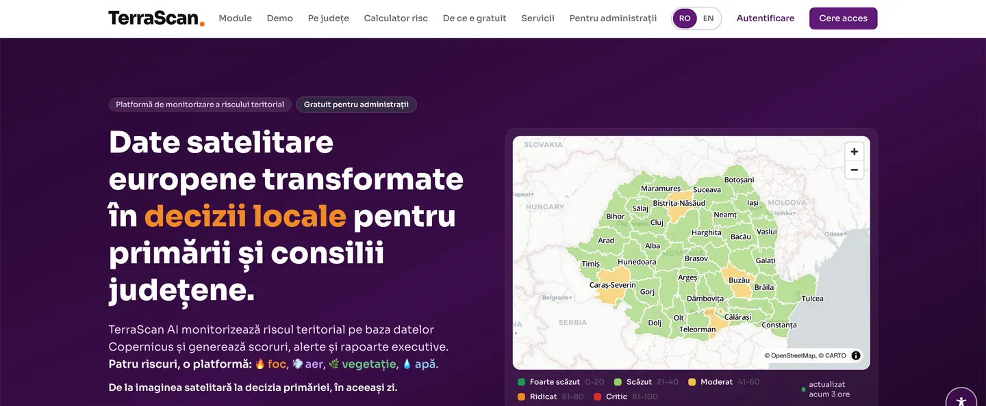
Four risks, one platform.
Each risk has its own module, with the measurements behind it shown openly. Scores run from 0 to 100, in five bands, from very low to critical.
FireGrid AI
Wildfire risk, based on fire weather, vegetation vitality and active fires detected by satellite.
AirGuard AI
Air quality, with fine particulate matter and the exposure of the county's localities.
RadarVerde AI
The state of the environment and vegetation: vitality index, drought, degraded land.
AquaWatch AI
Flood risk, with soil moisture and forecast rainfall.
of Bucharest
in parallel
from low to critical
administrations
What you see in the platform.
Screenshots from the public platform. It can be opened now, without an account.
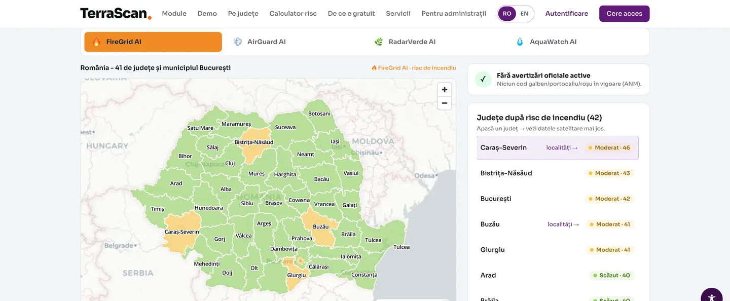
The map of the country, for each risk
All 41 counties and the Municipality of Bucharest, coloured by score. Alongside, the county ranking and the official warnings in force.
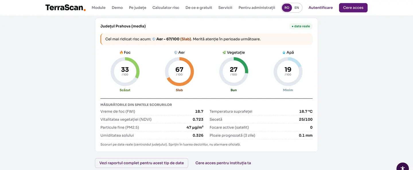
The county sheet, with the four scores
Fire, air, vegetation and water, each with its own score from 0 to 100. Below, the measurements behind the score: fire weather, vegetation vitality, fine particles, soil moisture.
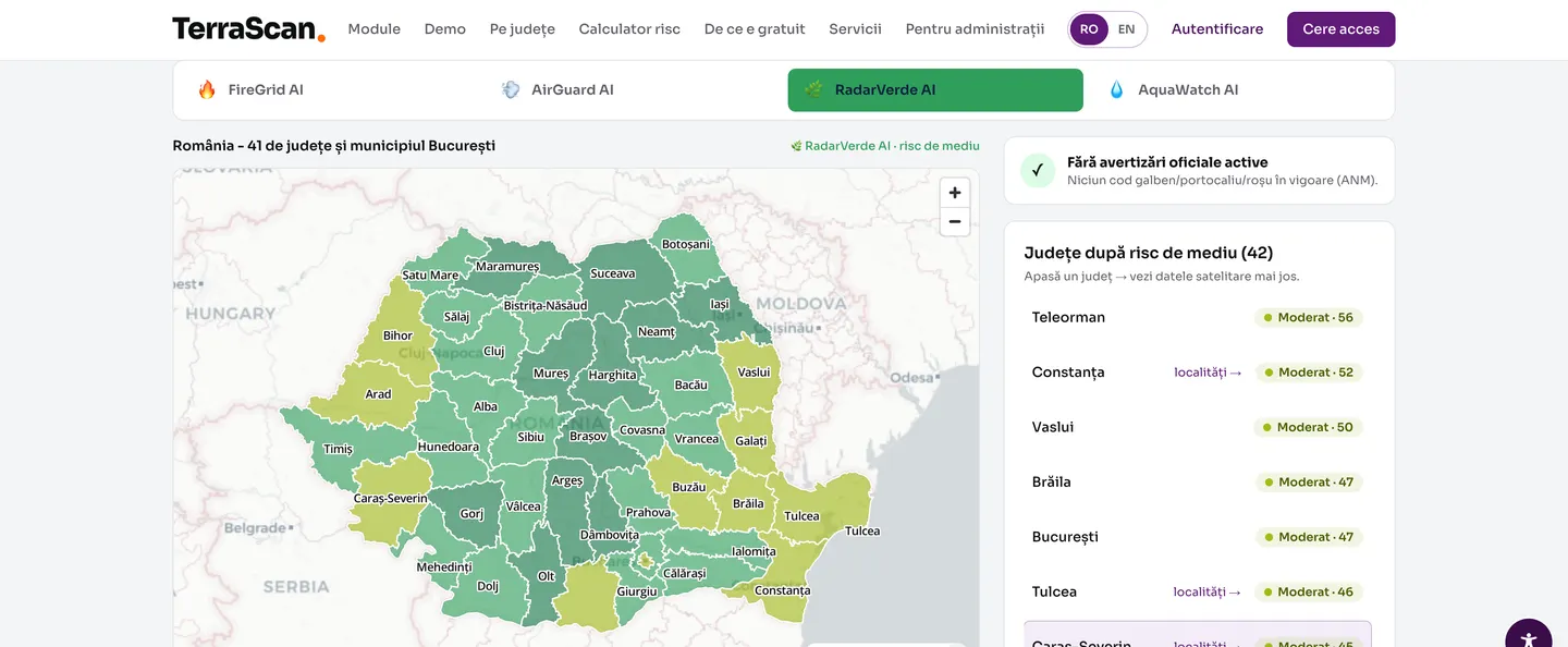
Each module, with its own map
You switch between FireGrid, AirGuard, RadarVerde and AquaWatch, and the map and the county ranking change with it.
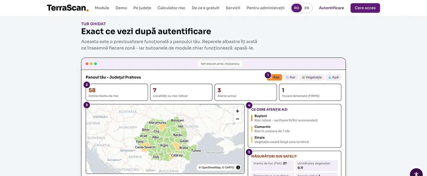
See the dashboard before you request access
A numbered tour of the institution's dashboard: the average risk index, the exposed localities, active alerts and the satellite measurements. The buttons work.
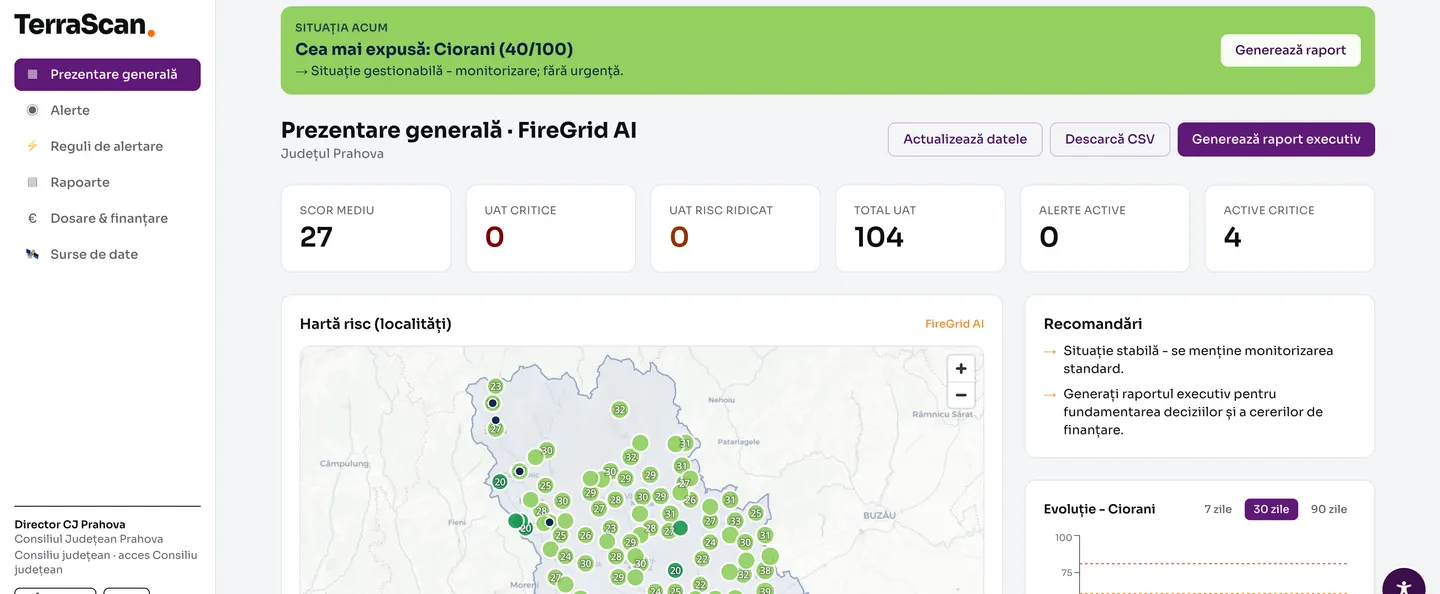
The institution's working dashboard
An overview of the county's 104 administrative units: average score, active alerts, the trend for the most exposed locality and an executive report generated for the funding file.
Why it is free.
The data comes from the European Copernicus programme. It has already been paid for with European public money and is free to use. There is nothing for us to sell there.
What we do is bring it into a form that a mayor can read in two minutes and put into a council decision. This layer stays open to public administrations in Romania, because it is worth more to everyone if it is used than if it is charged for.
Where we stop.
TerraScan supports decision-making; it is not an official alert system. Official warnings remain the responsibility of the competent institutions, and the platform shows them as such, next to the scores.
We do not intervene on the ground, we do not install sensors and we do not replace emergency management systems. Scores are calculated on real data, at the level of the county centroid: we say so in the platform, on every sheet.
A product developed by ARSC in its AI Studio.
Four products built by our own team, around concrete problems faced by local government. They stop at diagnosis, at the evidence behind a decision and at tracking the intervention; delivery is left to companies in the market.






Would you like access for your institution?
The public map is open to everyone. For the working dashboard for your county or locality, write to us.