Three interactive platforms run by ARSC, fed exclusively from official sources (PNRR, MySMIS, SEAP, INS, ANCOM, MIPE, MDLPA, ANRE). Free public resources, designed for journalists, researchers, public administrations and companies that take decisions on concrete data about Romania's transformation.
documented
(41 + the Mun. of Bucharest)
operational domains
sources
Three interactive platforms.
Each map meets a distinct need: the Smart City Map of Romania (projects implemented or under way), the Energy Projects Map (future renewable capacity) and the Smart City Index (a ranking of municipalities based on objective data). All are publicly accessible, free and without an account.
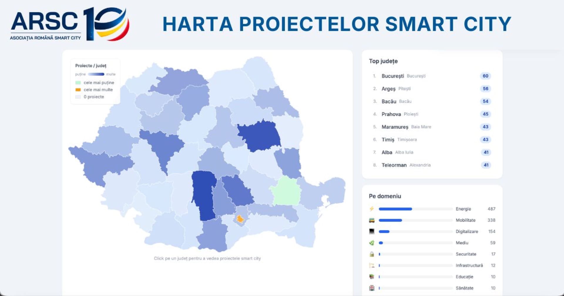
Smart City Map of Romania
An interactive SVG map of Smart City and Smart Village projects implemented or under way in Romania. Drill-down to county level, filterable exploration tools, extra layers for towns, municipalities and Functional Urban Areas.
- 1,720 documented projects
- 42 administrative units at level II
- 7 domains: Mobility, Digitalisation, Energy, Environment, Health, Education, Security
- Filters by category, status, year, full-text search
- Overlay of 41 FUAs (Functional Urban Areas)
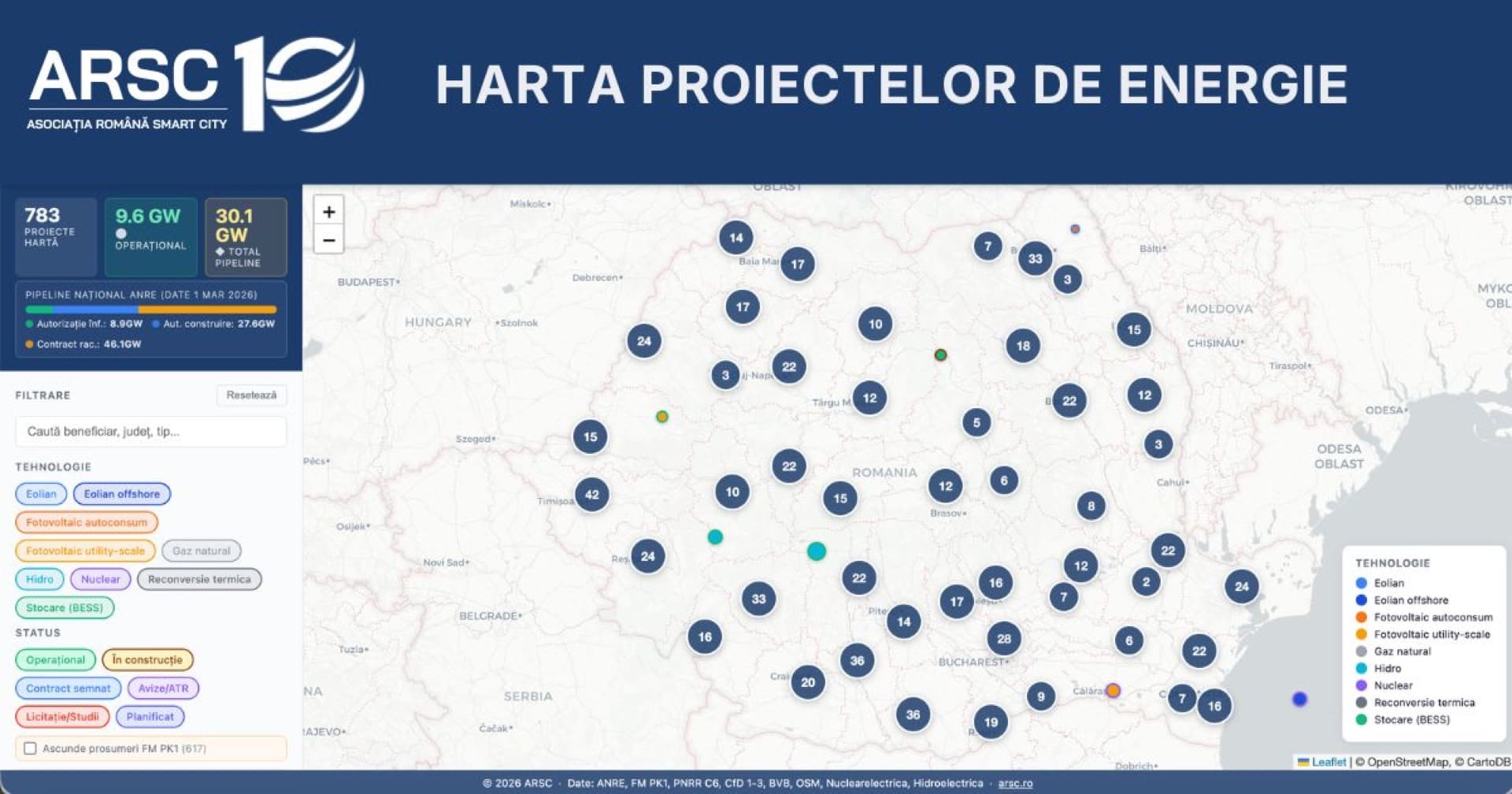
Energy Projects Map
The national renewable energy pipeline: solar PV, wind, hydro, batteries, prosumers. The map includes the electricity transmission grid (RET), with its 400 kV and 220 kV lines and substations, for grid connection analysis.
- Stage: Operational / Under construction / Planned
- Filters: technology, status, county, prosumers
- Transmission grid overlay: 400 kV and 220 kV lines, substations
- Alternative list view
- Official reference: the ANRE pipeline
assessed · 2026 edition
Smart City Index România
An objective ranking of county capital municipalities, based on 7 standardised indicators. Four levels of digital maturity, from "Initial" to "Advanced". A tool for direct comparison between municipalities and a map of maturity.
- 42 municipalities assessed (2026 edition, data collected in April 2026)
- 7 indicators: open data, digital services, infrastructure, investment, profile + 2
- 4 levels: Advanced (70-100), Developing (50-69), Emerging (30-49), Initial (0-29)
- /compare tool: direct comparison of two municipalities
- CSV export + open methodology
The 7 operational domains.
ARSC documents projects in Romania using an operational framework with seven domains, adapted to the real categories of public funding (PNRR, POR, AFM). This framework differs from the 6 academic verticals (ITU/ISO): see the applied explanations.
Mobility
Electric buses and minibuses, charging stations, depots, e-ticketing, smart traffic lights, smart parking, bike sharing, car sharing, intermodal transport.
Digitalisation
Citizen platforms, e-government, one-stop shops, online tax payments, WiFi hotspots (WiFi4EU), open data, AI / IoT, GIS.
Energy
Smart LED street lighting, energy efficiency of public buildings, micro-grids, solar panels on public buildings.
Environment
Waste management, air quality monitoring, digital waste collection points, urban regeneration.
Health
Telemedicine, eHealth, electronic health records, hospital digitalisation (PNRR component C12).
Education
SmartLab, digital equipment for secondary schools and schools, e-learning, tablets and laptops for pupils.
Security
Video surveillance, video analytics, smart alert, intelligent CCTV, integrated ITS systems.
How the data can be used.
All maps are public resources, free to access and without an account. The aggregated data can be cited freely in press articles, academic papers, reports and presentations, with the source credited.
ARSC attribution
When using the maps or the data, the credit "Source: Asociația Română pentru Smart City (arsc.ro)" is mandatory.
Non-commercial use
The data can be used freely for press articles, academic papers, research and public presentations.
Commercial use
For commercial integrations (in products, paid platforms, business intelligence solutions), please contact us in advance.
Modification & redistribution
Derivative works (analyses, your own visualisations, aggregations) are allowed, under the same licence, with ARSC attribution.
Do you need specific data?
For particular requests (a given city, a specific domain, an extended time series or an API integration), write to us; the ARSC team will reply to you personally within 48 working hours.